PhotoSec: The Island of Duvall
I’ve talked about the Snoqualmie River valley in previous posts. Duvall is on the east side and all of the rest of civilization is on the west. This includes cities like Redmond, Bellevue, and Seattle. In the city of Duvall, there are approximately 7,000 residents. I once heard a statistic that 60% of the households here have at least one person who works for Microsoft. That used to be true for my house but not anymore! 🙂
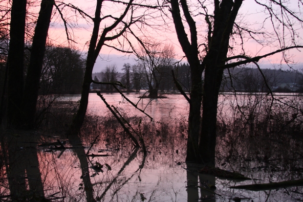
Anyway, there are two main roads into Duvall from the west side of the valley. 124th and Woodinville-Duvall Rd. It is a guarantee that a few times a year, 124th will flood. This usually occurs after heavy snow in the mountains followed by warming and lots of rain. Once about every five years, the waters will get high enough to flood out Woodinville-Duvall Rd as well. When this happens, Highway 203, which runs North/South through the valley, will also flood in several places effectively turning Duvall into an island. Now this isn’t 100% true because you can always go east into the Cascade Mountains but you’re not likely to get very far. The trick is to make sure you don’t get caught on the wrong side of the valley!
For the record, I handheld all of these shots so some of the ones I took before it got lighter out are a bit blurry.

This first shot is of 124th from the Duvall/East side. To give some perspective, the bridge is almost exactly one half mile from where I took the picture and the stop light you see on the other side is almost exactly one mile. The river is normally the width of the bridge.

The road you see here is Hwy 203 which runs N/S through the valley. The lights in the distance are from the prison in Monroe WA which is about 10 miles away.


I like the last photo!
Nice reportage photography. I would definitely not want to be caught on the flooded road or on the wrong side of the valley though it’d be a good excuse for not making it to work in the morning.
I’m lucky enough to be able to work from home quite a bit so if there’s a threat of both roads being closed, I just stay put. Thanks!
Wow! Hadn’t been watching the news lately and sometimes Portland stations are a little funny about covering Seattle stuff so hadn’t heard about this… then again, it sounds fairly common and might not be newsworthy enough for those of us at a distance. 😉 Great pics though.
Thought I would let you know that I’ve included you on my versatile blogger list – http://beingjulz.com/2012/04/05/thank-you-for-the-versatile-blogger-award/
The local news does tend to cover it but mainly only the first time of the season and when it’s really bad. Thanks for including me on the list!